
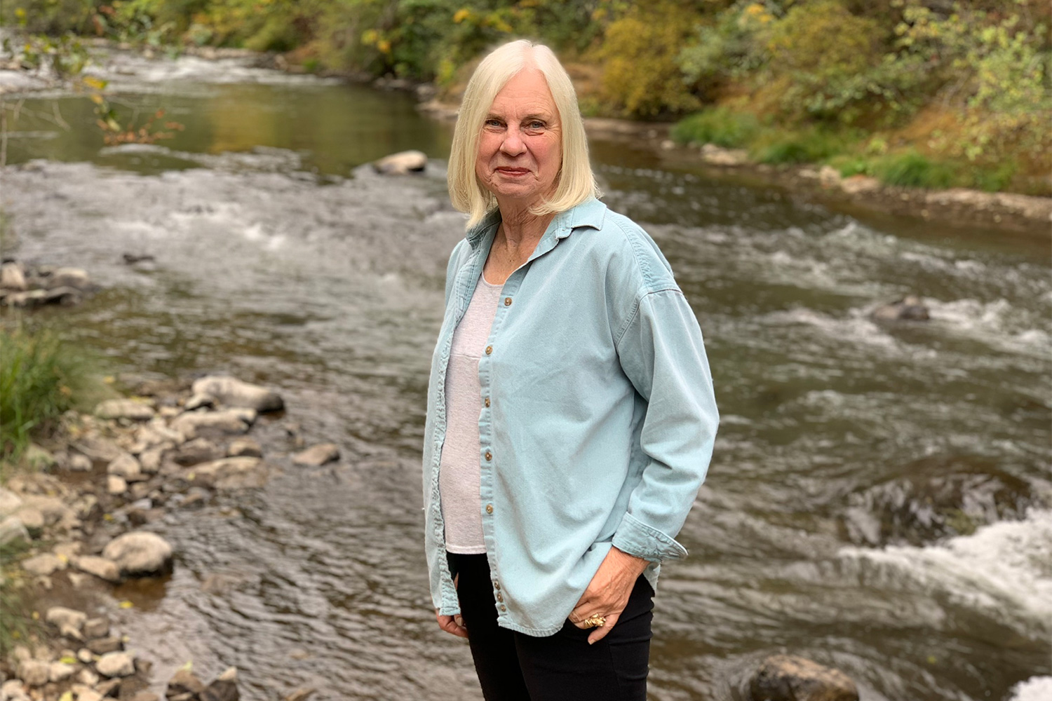
It began as a tempest, the likes of which Nancy Behm had never felt in more than 70 years of living in Blue River, Oregon.
“East winds are always a little spooky. They’re different creatures,” Behm says. “But this was very, very intense. And I could hear trees and branches cracking, breaking, falling.”
The storm was somehow soothing, though, and Behm fell asleep to the sounds it made against the walls of the old farm home her parents had built back in 1953.
At midnight Behm woke to a call from her grandson. “There’s a fire at Holiday Farm,” he told her. “You need to evacuate.”
Holiday Farm was up Hwy 126, miles away. “In my slightly sleep-addled mind,” Behm says, “I figured I had some time to get organized and make plans.”
But when she walked outside and scanned the ridge, the sky was orange.
“It had been a couple of years since I had done any running,” she says, “but, oh boy, I definitely remembered how to do it.”
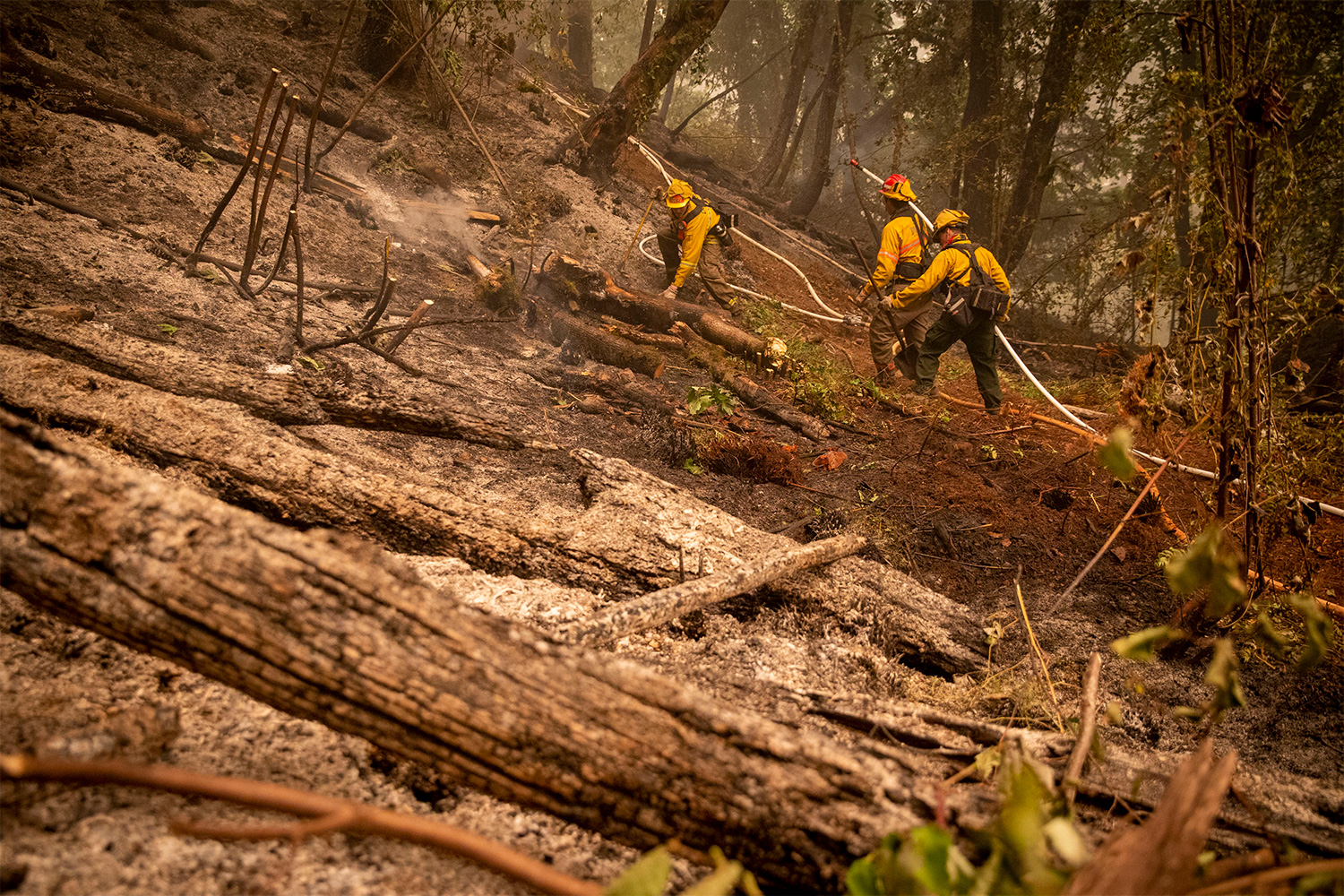
The Holiday Farm Fire would go on to burn for more than a month, taking with it some of the most beautiful land Oregon has to offer. It grew to nearly 175,000 acres. That’s an area the size of New York City — and then some.
Blue River was one of dozens of towns devastated by the scores of fires that burned across the western U.S. in early September. Dozens of people were killed in the blazes. Hundreds of thousands had their lives upended. And as for the total acreage? Think not in terms of cities but states — the charred ground covers an area of land the size of New Jersey.
It does not take a meteorologist to guess that the incredible winds that preceded the blazes in Blue River, and all across the West, were complicit in the fires. Where relatively small wildfires were already burning, as they do across this area of the country every summer, the hurricane-force gusts stoked and pushed the flames across roads and rivers, up streakbanks and down mountain valleys. Where there were not yet fires, the winds downed power lines, sparking new blazes, which rapidly grew to infernos under the same winds.
In the wake of these conflagrations, many have noted the role of climate change in creating conditions for fire, ascribing the term “climate wildfires” to these events — and correctly so. Climate change is increasing wildfire risk through warmer temperatures and prolonged drought – stacking the odds in favor of infernos. Meanwhile, human fire suppression efforts have led to more dense vegetation, which then dries, brittles and inevitably burns when the region’s climate once again leans hot and “fire weather” prevails.
As for those winds, though? They have mostly been treated as a freak event — an historic and untimely phenomenon that simply happened to arrive at the worst possible moment.
But emerging meteorological evidence suggests the massive wind event that fueled fires in Oregon and across the West in early September may itself have been stoked by a surprising source: violent storms that began an ocean away. If that is so, it would be one of the first documented cases in which one deadly weather disaster can be shown to have helped trigger a completely different one.
And in a world in which climate warming is intensifying many kinds of extreme weather events, the implications could be profound.
BEYOND IMAGINATION
Inje University researcher Jong-Kil Park has been studying weather-related disasters in South Korea for nearly 20 years, but even he was taken aback by what happened in late August and early September.
“It was beyond imagination,” he says.
First came Typhoon Bavi, which reached the Korean Peninsula on Aug. 26, causing minimal damage in South Korea and Japan but more widespread destruction in North Korea.
Next came Typhoon Maysak, which reached the Korean Peninsula and Japan on Sept. 2, resulting in thousands of evacuations, widespread power outages and several deaths. The storm was also blamed for the wreck of a cargo ship, Gulf Livestock 1, which sank with 43 crew members, only three of whom were rescued.
Finally, there was Typhoon Haishen, which reached Korea and Japan on Sept. 6, resulting in widespread flooding, mudslides, several deaths and the closure of two nuclear power plants.
Typhoons are not usual in the west Pacific. These storms are usually born in warm, energy-rich tropical waters and move poleward from there. But most have significantly dissipated once they reach the considerably colder, energy-poor seas surrounding South Korea, the southernmost point of which — the tiny island of Marado — rests about 33 degrees north of the equator.
These three storms, though, were different.
“Even when they came above 33 degrees north latitude, they existed as very strong typhoons,” Park says. “In the past… they would have passed the peak period and entered the period of extinction.”
Park lives in the southeastern port city of Busan, where both Maysak and Haishen made landfall, cutting power to homes, felling trees and forcing the cancellation of train and plane travel. He was jarred by the ferocity of the storms.
“It was difficult to sleep due to the strong winds,” he says.
At the right time of year — if a cyclone is strong enough and the waters are warm enough — typhoons can make trouble in Korea.
“Usually, landfall of one typhoon is expected every year close to September in the Korean Peninsula,” says Professor Yuei-An Liou, whose work at Taiwan’s National Central University is focused on measuring meteorological events in Asia.
So if Bavi or Maysak or Haishen had struck the peninsula, it would not have been abnormal. But three typhoons in a row? Liou calls that “a unique event.” It was the first time on record that three typhoon-strength cyclones had struck the Korean peninsula in such quick succession.
To the extent that the global media focused on the cyclonic trifecta that thrashed the Koreas and Japan, however, it was mostly as a series of localized disasters. While noting that North Korea was grappling “with heavy rains and floods in one of the wettest rainy seasons on record,” Reuters reported on the storms’ repercussions in political, rather than environmental terms, focusing on North Korean leader Kim Jong Un’s reconsideration of year-end projects in the wake of typhoon-related damages. If not for the dramatic video of the rescue of one of the Gulf Livestock 1’s crewmember, the storms may not have warranted much more than a mention on the BBC. And CNN’s coverage was mostly limited to damages — the global news network’s website ceased coverage of the typhoons on Sept. 7.
That happened to be the day the U.S. Joint Typhoon Warning Center issued its last bulletin on Haishen. At that point, the center reported, it was no longer a typhoon but an extratropical low pressure system — a seemingly inconsequential area of counter-clockwise-spinning winds in the middle of the North Pacific. And as for the two preceding storms? They seemed to have disappeared into the ocean winds.
But that may not be the whole story.
A BUTTERFLY IN BUSAN
To understand how a cyclone in the western Pacific could impact weather an ocean away, a good starting point just happens to be one of the world’s best-known scientific laws.
Isaac Newton often gets credited with the law of conservation of energy, but Newton’s work, starting in the late 1600s, was centered on force and momentum. That’s the scaffolding for understanding the movement and flow of a fluid, but Newtonian physics alone isn’t enough to describe typhoons.
More than 20 years after Newton’s death, however, the philosopher, mathematician, Biblical scholar and gambler Émilie du Châtelet made an important leap. In a commentary on Newton’s conservation principles, du Châtelet suggested that energy itself is neither created nor destroyed. Under this unifying framework, the motion and potential of everything in the world — from falling apples to spinning planets to howling typhoons — could be better accounted for.
It’s unlikely, of course, that du Châtelet was thinking of typhoons when she conceived of energy conservation. But these western Pacific storms — like all weather events — are at their most basic a consequence of the movement of energy. They pick it up in one place; they distribute it to another.
But where exactly does it come from, and where precisely does it go? That’s generally hard to know. The ocean is a huge and amorphous thing. The atmosphere even more so.
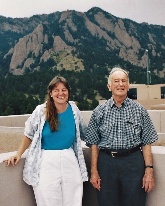
The infinite ways in which energy might travel through these vast environs was at the heart of the work of Edward Lorenz, an American mathematician and meteorologist at the Massachusetts Institute of Technology. Obsessed with improving the predictability of weather, Lorenz was a pioneer of computer forecasting. But one day, having rounded the inputs in a forecast equation by a few ten-thousandths of a percent, he saw that his results were wildly divergent — not just a little different, but completely different.
“How could it be so different? It was a problem he couldn’t figure out,” says Lorenz’ daughter, Niraja Cheryl Lorenz, a former research psychologist who is now an artist in Eugene. “He went away for a coffee to think about it. At first he thought it must be a glitch in the computer… but he kept pursuing it.”
For Edward Lorenz, the limits of prediction — the chaos embedded into a system so big, so complex, that it could never be fully quantified — became a new obsession. And in the early 1970s, he came up with a metaphor to describe that chaos. Speaking to his colleagues at the 139th meeting of the American Association for the Advancement of Science, Lorenz asked, “Does the flap of a butterfly’s wings in Brazil set off a tornado in Texas?”
“In more technical language,” Lorenz continued, “is the behavior of the atmosphere unstable with respect to perturbations of small amplitude?”
The question at the heart of “the butterfly effect” has been asked in countless ways since then.
And the answer, chaos theorists have since concluded, is “sure.” For when it comes to complex dynamical systems, like weather, small changes in initial conditions can have profound effects on eventual outcomes.
But what if it’s not a butterfly? What if it’s a typhoon?
JET SET
Energy is often palpable. An object with a lot of energy usually feels hot to the touch, as energy in the form of heat is spewed from it.
Latent heat, however, is much more mysterious to human senses. This “hidden” energy only becomes available when water undergoes a phase change — for instance, when rising vapor condenses into liquid droplets, as happens in a typhoon.
Drop by drop, it’s inconsequential. But as typhoons suck up vast amounts of moist air — which then rises, cools and condenses — the amount of energy that comes out of “hiding” is staggering. By one estimate from the National Oceanic and Atmospheric Administration, the energy released in this process may be 200 times greater than what the entire global energy industry can generate in a single day. The latent heat is drawn within the eye of the storm and released into the upper troposphere, pushing upward on the layer of this part of the atmosphere wherever the storm goes.
That’s what Bavi, Maysak and Haishen were doing in late August and early September.
Like many powerful tropical cyclones — hurricanes in the Atlantic and eastern Pacific oceans, and typhoons in the Indian and western Pacific oceans — Bavi, Maysak and Haishen all began in warm waters. And, like most such cyclones, they all began in a westerly direction, then turned poleward and eventually redirected east — a phenomenon known as recurvature. At this point, some typhoons take on a completely new form. At higher latitudes, a symmetric, tightly wound tropical cyclone becomes skewed and distorted, resulting in an extratropical storm that is now fueled by large differences in temperature and moisture within the air. That’s when most such storms become uninteresting to all but the most ardent meteorological observers.
But Fraucke Feser, who studies extratropical cyclones at the Helmholtz Center for Materials and Coastal Research in Geesthacht, Germany, knows better than to ignore an extratropical cyclone, no matter how diminished from its original state it might seem. Her examination of Hurricane Gonzalo — the second tropical cyclone to directly strike Bermuda in a one-week period in October 2014 — has revealed that the storm was a lot longer lived than commonly believed.
Gonzalo formed on Oct. 12 of that year. It reached peak intensity north of the Greater Antilles on Oct. 16 and ostensibly dissipated on Oct. 19. But in reality, Feser and her collaborators have found, Gonzalo didn’t die out in the cold waters of the North Atlantic. Instead, it was absorbed by a cold front, resulting in a restrengthening of the storm. Two days later, hurricane-force winds were felt over the United Kingdom, with gusts up to 87 mph, impacting transportation throughout Europe. Flights were grounded. Ferries were cancelled. Falling trees killed several people and injured many others.
Feser has since identified many cyclones of this sort. “These storms are among the strongest former tropical storms that travel such large distances towards Europe,” she said.
Those long journeys take these cyclones into a part of the world where the jet stream often is. And that offers another avenue for life after apparent death — for if a cyclone can track far enough north to hit this strong band of westerly air currents, the impacts can quickly travel downstream.
That’s what appears to have happened in September 1995, when Typhoon Oscar ravaged Japan, killing eight people and destroying hundreds of homes before recurving back out to sea. By most accounts, that’s where the storm died, as most storms begin to do at a similar point in their lifecycle. But when a team led by atmospheric scientist Heather Archambault reanalyzed Oscar’s path more than 15 years later, they saw something more.
After recurvature, the remnants of the storm had traveled north and met up with the jet stream, amplifying the intensity of polar-circulating barriers of high and low pressure, known as Rossby waves. These waves play an outsized role in shaping weather across the middle and higher latitudes — and in particular wind, which is the movement of air from higher to lower pressure areas. Oscar’s bump, Archambault and her colleagues concluded, had intensified a massive high pressure system over the United States.
The result was an early season cold-air outbreak. The freezing winds that tore through the Midwest in late September of that year resulted in the earliest freeze on record for more than a half-dozen cities.
The chain of events studied by Archambault’s team bore a striking resemblance to what transpired in the western United States in September of this year.
But was it a similar phenomenon? Did one unprecedented weather event beget another, an entire ocean away?
An analysis of forecast and observed weather data suggests it may have done just that.
CHASING WAVES
In a world of endless butterflies, identifying the one responsible for starting a meteorological event isn’t easy.
But when it comes to disturbances that impact Rossby waves, there is a tool that can help — an equation developed by University of Tokyo physicists Koutarou Takaya and Hisashi Nakamura that has been used by thousands of atmospheric scientists to derive “wave activity flux.” The equation helps researchers infer where energy was emitted and absorbed thousands of feet into the atmosphere, and can be used to track flux across long expanses. This tool is especially handy for determining the cumulative impacts of events – or the energy propagated by three typhoons.
Sure enough, along with National Center for Atmospheric Research pressure data from late August through early September, the equations help create a picture of an eastward propagating flux that begins with each typhoon and travels across the North Pacific.
The data indicates that Bavi, the first of the western Pacific storms, generated a flux of wave activity to its immediate east and, four days later, a corresponding increased flux appeared over the Gulf of Alaska. The process was repeated — perhaps with strongest effect — in the wake of Maysak, and again following Haishen. Each time the flux appears to have helped crank up the volume of a Rossby wave configuration that was setting up over the western United States.
In figurative and ultimately literal terms, that was fuel to the fire, because disparities in atmospheric pressure, such as the extreme differences found between the ridges and troughs of Rossby waves, result in air movement from higher to lower pressure areas, which in turn results in wind. And in early September a western ridge of hot and dry air was already precariously stationed above North America, with a high pressure region that began with a nearly poleward ascent through Alaska and which came crashing down across the western United States.
The fact that the amplified Rossby ridge came at the same time as the fluxes that traveled across the Pacific is not evidence of causality, no more so than the presence of a knife at a homicide scene necessarily means it was the murder weapon. It’s possible, of course, that the extreme winds could have occurred even without the extra bump to the system.
For that reason, it’s helpful to consider what might have happened if those additional waves had not entered the system — a complex hypothetical question that can be examined with publicly available data from the Global Ensemble Forecast System, which is used by meteorologists across the world to predict different possible weather scenarios by generating a diversity of forecasts, each minutely different from original observations. With this system, it is possible to look at scenarios that embrace a trove of potential weather conditions.
It is also possible to look at weather scenarios that missed something important — the typhoons.
In forecasts that play out without accurate realizations of the three typhoons, what happens to North American weather in early September? The severe amplification of the Rossby waves — the most powerful driver of winds at these latitudes — is greatly reduced.
It’s impossible to say that the fires in Oregon could not have happened under a less amplified environment. The hot and dry conditions were already there, after all. Perhaps all it would have taken was an errant match, or a lightning strike, to set things into terrible motion.
But Clark Evans, who researches tropical cyclones at the University of Wisconsin-Milwaukee, says the idea that the typhoons ultimately contributed to the recent fire weather tracks along with emerging research.
“It makes sense that western North Pacific recurving typhoons would be found to contribute to ridging over western North America,” Evans says. “When the interaction of the recurving typhoon with the large-scale pattern is constructive or strong, the downstream response typically favors a ridge over western North America.”
Young-Hwa Byun, the director of the Climate Research Division at the National Institute of Meteorological Research in Korea, agrees.
“I think it is possible,” she says, “that a strong enough typhoon in East Asia can play a role in strengthening Rossby wave ridges and troughs reaching North America.”
But what is possible in “perfect storm” sorts of scenarios, like this one, might not be probable in other instances.
“Think of it kind of like a choir or orchestra,” Evans explains. “When all of its members are in harmony, they amplify the sound into something beautiful and impactful. If I were one of the members, though, the exact opposite would happen — a cacophony of noises.”
In other words: A lot of conditions would have to align in order to make that particular meteorological domino effect occur again. But those conditions may, in fact, be growing more common.
ON WARMING SEAS
Typhoons are born in warm seas.
It might seem to stand to reason, then, that warming seas would give rise to more frequent cyclonic storms. But sea-surface temperatures are only one of many variables affecting typhoon development. Humidity also plays a role. So do atmospheric instability and the strength of existing winds.
Given the way climate change is impacting those other variables, Byun said, it’s possible that the number of typhoons in the Pacific might actually decrease.
But in the past, the cooler waters around Korea served as a buffer to typhoon development. If sea-surface temperatures rise, Byun said, it would increase the likelihood that whatever storms are born in the tropics will hold their strength as they move north.
“Even if the number of typhoon occurrences is not very different from the present or is somewhat smaller,” she says, “I think that once a typhoon occurs, it may be a strong typhoon.”
All of this rests on the notion that the waters in the west Pacific are, in fact, warming. And that, like so many climate stories, is complicated. Several recent years have been among the warmest on record for sea surface temperatures in this area, but it is also an area known for significant multi-decadal variability as well as quickly fluctuating warm and cold patches.
In the month in which Bavi, Maysak and Haishen were born, in fact, the seas immediately surrounding the Korean peninsula were actually a bit cooler than a 30-year average of the same month taken from 1980 to 2010, according to data from the Japan Meteorological Agency. But that same comparison shows a very warm region of ocean south of Japan, which may have been a great source of potential fuel for typhoons.
For Park, of Inje University, it’s all quite troubling.
“Sea surface temperature is expected to rise further in the future,” he noted.
Suryun Ham, a climate scientist at the Asia-Pacific Economic Cooperation Climate Center in Korea, agrees.
“It is known that sea surface temperatures in the southern Sea of Japan and Philippine Sea, where typhoons affecting the Korean peninsula are created, have risen to a maximum of 30 to 31 degrees Celsius,” she says. Ham notes that’s about 10 percent warmer than long-term observations and models have suggested is normal in those waters.
“The typhoon created in this way,” she says, “advances further north than before.”
That, in turn, could increase the chances that a storm could travel far enough north to connect with the jet stream, thereby adding its energy to pressure waves that will ultimately affect weather in North America.
THE DRAGONS IN BLUE RIVER
Climate change is often spoken of as something that will happen in the future. The reality, though, is that it has already happened, it is continuing to happen, and the implications are still being uncovered.
So maybe warming oceans fuel typhoons. And maybe typhoons crash into the jet stream. And maybe the jet stream amplifies downstream pressure waves. And maybe the wind blows stronger. But what does that mean against the totality of global warming?
It would not be unreasonable to wonder whether it matters in a world in which many scientists believe humans have already pushed the Earth well past the point of no return — a world in which catastrophic levels of warming are simply inevitable.
“The thought that we can ever go back to some pristine pre-industrial environment is sheer hubris,” says climate scientist Danielle Lemmon, a post-doctoral researcher at the University of Busan. “Even if we removed all carbon from the atmosphere tomorrow, the Earth would still be in a transient warming state, and we would still need to mitigate those effects.”
There is no going back, they said.
“Some people may call that ‘doomsday alarmism,’” Lemmon says. “I call it an opportunity for us to do what humans have always done best — collectivize and problem solve the issues at hand.”
Among those issues: Higher temperatures and deeper droughts have turned the West into a tinderbox. And sure, in that world, the typhoons-to-fires connection might be nothing more than another butterfly in a world of fire-breathing dragons.
But a month after fleeing Blue River, as she checked out of the latest in a series of hotels en route to look for an apartment in which to stay — perhaps for as much as a year to come as her family home is repaired — Nancy Behm was still fixated on that mighty wind.
She’d left her home with little more than a laundry basket of her belongings, driving down a road lined with flames, “just like the videos you see.”
The heat was surprising, she recalls, but the wind was astonishing.
“It was creating all these sparks, blowing smoke, blowing debris this way and that,” she says. “If you’ve ever started a fire with bellows, you know what a difference it makes. That’s exactly what it was like. That’s what the wind was doing.”